
Watoga State Park, WV - Day 2

View of the Greenbrier River from Monongaseneka Trail in Watoga State Park
Note: Some links throughout our site are affiliate links, which means we may receive a small commission at no cost to you.
This is the second post in a series for this trip. You can view links to the other posts at the bottom of this one.
On our second full day at Watoga State Park, we hiked Monongaseneka Trail (5.5 miles after we added some neighboring trails to create a loop plus 2 miles on bike to return to our car), and biked 15 miles on the Greenbrier River Trail, which we accessed about 30 minutes away so that we could catch the segment of the trail through the 400-foot long Droop Mountain Tunnel.
If you just want to skip to our adventure, scroll on; if you’re looking for some packing tips, here are our top gear recommendations for this trip. You can view more recommendations on our Ultimate Guide to Hiking Gear.
Comfortable hiking clothes - Our favorite options all come from REI. My favorite pants are prAna Halle and these are my favorite lightweight hiking t-shirts. Dustin has a couple of pairs of pants from prAna and the REI brand.
Light-weight raincoat - if there's a chance of rain, you won't regret bringing a lightweight waterproof jacket with you. My favorite is this GORE-TEX jacket, and it has seen many damp trails!
Hiking boots - Our current favorite brand is Oboz. Dustin has their Sawtooth model, and I have the Sapphire.
Hydration backpack - unless you are going for a very short hike, bringing water is a must. Dustin has a very old Camelbak circa 2000, and I have a new-ish one from Gregory that I have used on multiple hiking trips and love. While the Gregory Sula 16 is not currently available, here are some other options. We each have a 3-liter water bladder.
Headlight style flashlight - A headlight, like this one from REI that we each use, was handy for our bike ride through a dark tunnel since our bikes don’t have lights on them.
Day 2: Hiking Monongaseneka Trail at Watoga State Park and Biking the Greenbrier River Trail through Droop Mountain Tunnel
Hiking a loop trail: Monongaseneka trail to river view loop to north boundary trail to bear pen trail
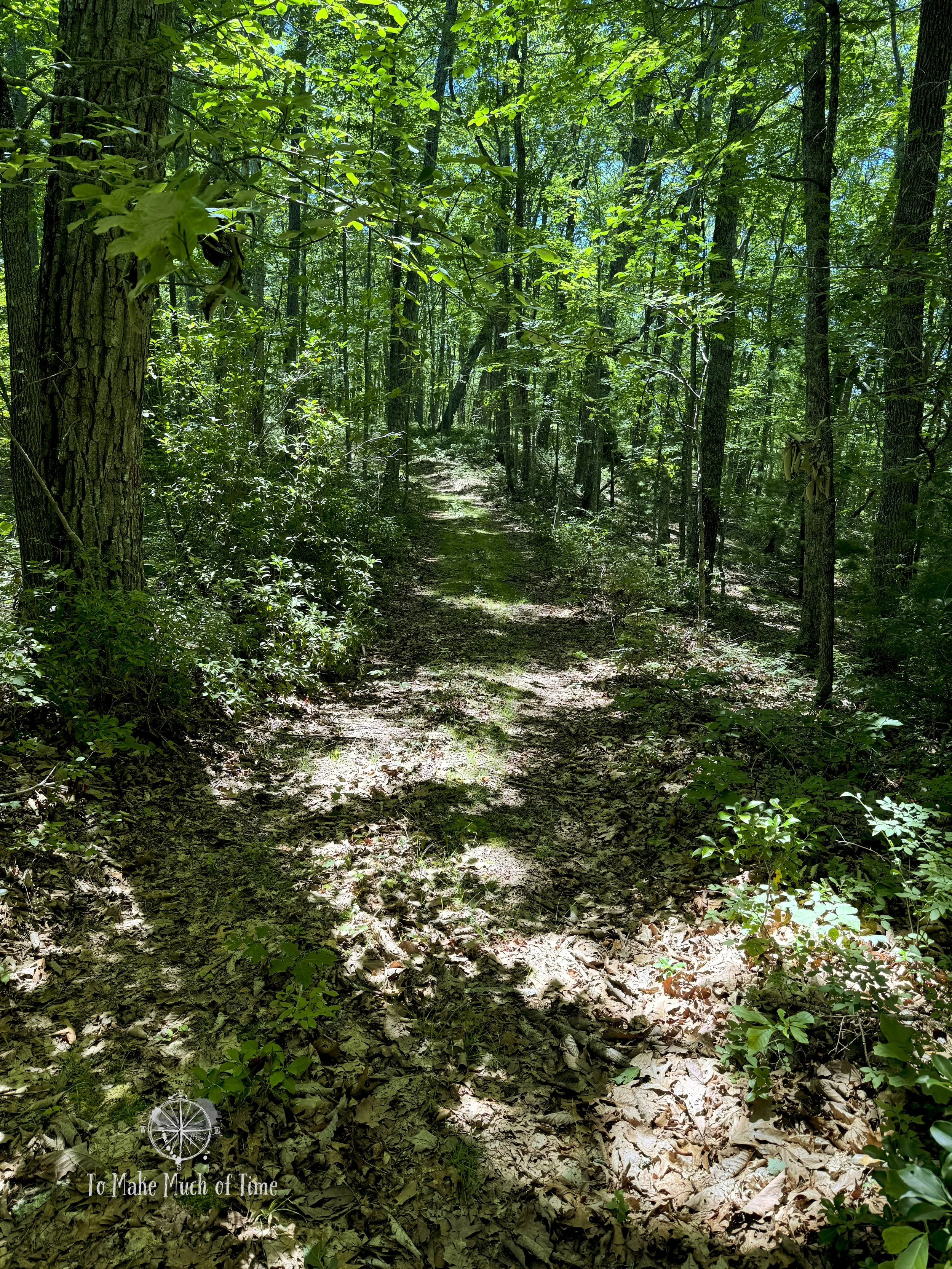
After a leisurely breakfast at the cabin, we headed for our morning hike on Monongaseneka Trail. The trailhead to this route is right off the main road in the park and has a small (5-6 car) parking lot across the street. The trail itself takes an immediate steep incline off the road and gains some quick elevation before evening out up the hill.
Monongaseneka Trail is listed as 2.5 miles one way, so while our initial plan was to hike it out-and-back, something we always try to avoid, we ended up turning it into a loop trail. Our total route – which I’ll describe in more detail below – clocked in at 5.4 miles and took us 3 hours 17 minutes (including stops for photos and a snack). One note, though is that we exited the loop we created right near our cabin and then still had to go two miles back to where we left our car, which we did later in the day on our bikes. So this longer loop was really about 7.4 miles.
Once Monongaseneka Trail leaves the road and heads uphill, it veers into the deeper recesses of the park, culminating near the park’s north border. This trail is definitely for foot traffic only and was nearly always a narrow, single tracked trail along the side of the mountain. Watching your footfall is important!

Trailhead for Monongaseneka Trail

Turtle on Monongaseneka Trail
There were some neat rocky sections, though they were fairly limited. We also spotted a turtle (or a turtle shell?) who was hanging out next to the trail. As with many trails in the park, there were lots of Rhododendrons and Mountain Laurels with the occasional bloom on the former. And as with other trails in the park, the maintenance of the trail has been a tad . . . lax. We continued to climb over numerous downed trees until we got to a section where several spindly trees had fallen across the trail in a jumbled mess. There was no way to go over or under them, so we scaled the steep incline of the mountain above the trees to rejoin the trail. There were other sections that were fairly overgrown, but the trail was always clearly marked and easy to follow.

A rocky portion of Monongaseneka Trail

Significant downed trees on Monongaseneka Trail had us scaling the mountainside to continue on the trail

Parts of Monongaseneka Trail were overgrown - you can see Dustin among the growth!

More overgrown parts of Monongaseneka Trail

Most of Monongaseneka Trail was not overgrown though!
After a hike uphill, we found a sign indicating a ½ mile River View Loop. Given that the Monongaseneka Trail is listed as having pretty views of the Greenbrier River and the loop is visible on the trail map as being part of it, we took the loop. Based on the final distance we hiked, though, it appears that the Monongaseneka Trail when combined with this loop is actually 3 miles instead of the advertised 2.5.
The loop portion of the trail meandered out along a ridgeline and culminated in a sweeping vista of the surrounding mountains and Greenbrier River below. It is one of the prettiest views from a trail in the park. We hung out there for a bit to eat a snack and enjoy one-bar internet service since most of the park is fully in a dead zone. As we’re both using the Duolingo app to learn Portuguese and have solid streaks of daily activity going, we took a moment to check our daily language lessons off the list.

Overlook from Monongaseneka Trail

Gorgeous views from Monongaseneka Trail
After looping back and continuing the Monongaseneka Trail to its terminus, where it meets up with the North Boundary Trail, we decided we didn’t want to return back the way we came and made our plans to turn our trek into the larger loop. Along this segment, we spotted two different toads – one that was mostly brown/gray with black spots that hid very nicely in the leaves, and a second one that was mostly black with some orange peeking through.

Toad (or frog, who knows?!) on Monongaseneka Trail - can you spot him?

Monongaseneka Trail

Monongaseneka Trail
Monongaseneka Trail
North Boundary Trail – which is named literally for the fact that it is along the park’s northernmost property line – is a fire road style trail. After lots of up and down hill during the first part of our hike, we enjoyed the 1 ¼ mile walk along this trail that mostly followed the ridgeline. Finally, we met up with the Bear Pen Trail and took that for about 1 ¼ mile until we met up with one of the trail exits near our cabin.
Bear Pen Trail through that portion (the trail itself is much longer) was gorgeous and peaceful. It was almost entirely downhill and within a Rhododendron forest. It was here that we met our first and only other hiker – a man with four large dogs, 3 German Shepherds, 1 unknown breed that was probably a German Shepherd mix. He had two dogs on a leash and two running wild until he saw us and then tried to get them to come back to him. The two rogue pups saw us and the one of the unknown breed variety charged up the hill towards us, tongue flopping to the side and with a gleam of something in its eye that was either unbridled joy or something else that made Dustin call out to the man: “Are they friendly?” to which we received a resounding “yes.” As much as I love dogs and enjoy watching them tromp through the woods freely, it definitely bothers me to see dogs off leash in places that clearly indicate they should be leashed.

Bear Pen Trail at Watoga State Park
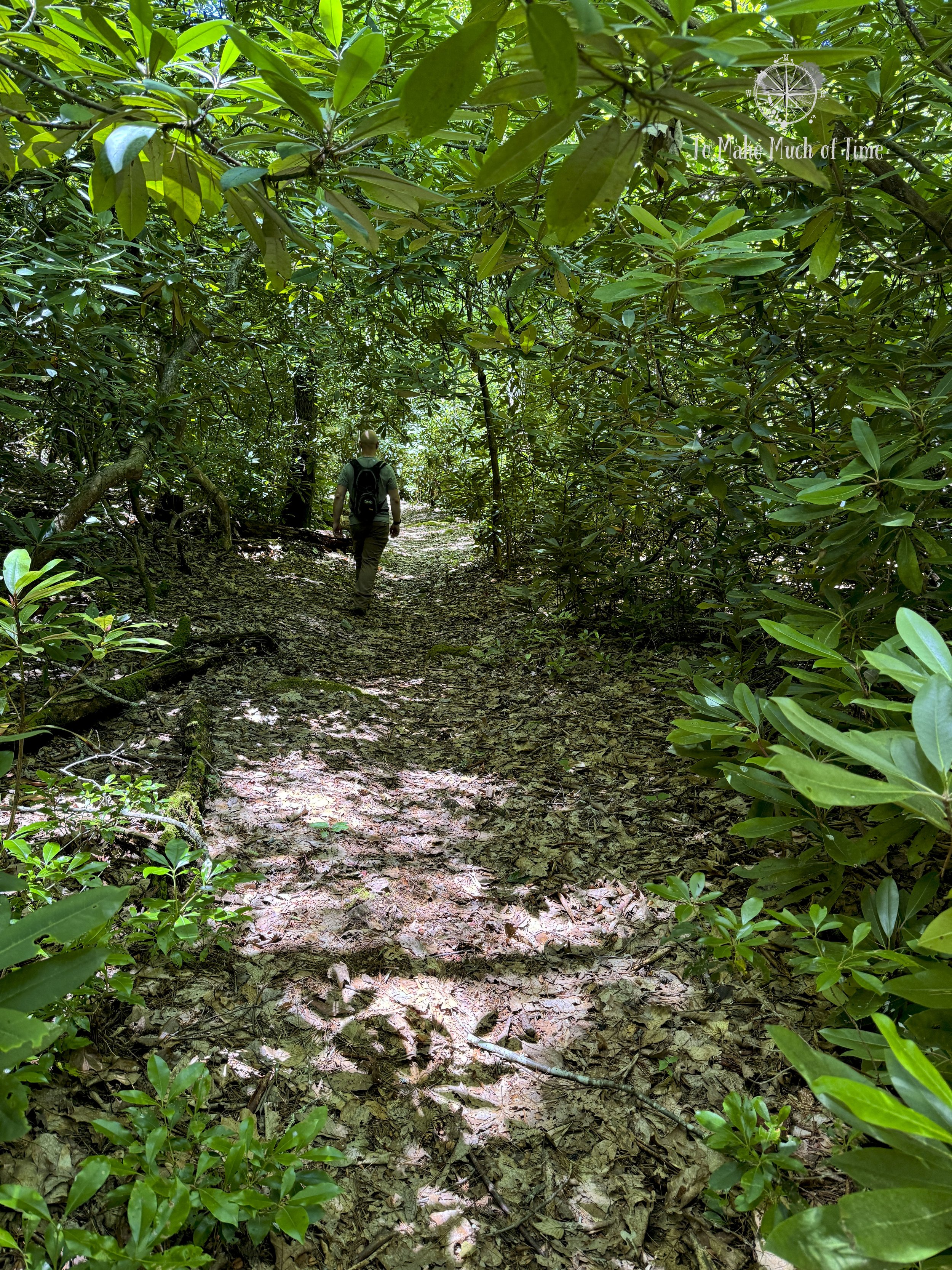
Bear Pen Trail at Watoga State Park had lots of Rhododendron

Fern field along Bear Pen Trail at Watoga State Park
Finally, we reached the main road after crossing a small bridge, and headed home for lunch and dog walking. We definitely enjoyed doing this as a combined loop trail for much more forest and topographic variety.
biking greenbrier river trail from beard to droop mountain tunnel
Our plan for after lunch was to head to Greenbrier River Trail for some biking. Because our car was still two miles away at the trailhead, we hopped on our bikes and coasted the entire two miles downhill.

Beard access point to Greenbrier River Trail

Biking the Greenbrier River Trail from Beard to Droop Mountain Tunnel
When we visited Watoga State Park two years ago, we had biked a portion of the Greenbrier River Trail from the nearest access point in Seebert (literally a minute from the park) north to Buckeye. To see different portions this time, we decided to drive to another access point that would allow us to check out the Droop Mountain Tunnel. We drove 30 minutes to the Beard access point, which is at mile marker 38.5. (Seebert is at 45.8). The drive to Beard took us through the closest small town of Hillsboro and the surrounding countryside, which is absolutely gorgeous: rolling hills, beautiful blue mountains, basically quintessential country views.
As an unexpected view, right near the access point in the small town of Denmar was a medium security prison (Denmar Correctional Center), surrounded by barbed wire. There were literally houses across the street, which I can’t fathom. And the best was a sign that warned drivers not to pick up hitchhikers. Duly noted. A quick internet search (later, when we had internet) confirmed that they have had escapees in the past.

Greenbrier River Trail

Greenbrier River Trail

An evening bike ride along Greenbrier River Trail

Greenbrier River Trail
The parking lot along the Greenbrier River Trail looked like it could hold 8-10 cars, perhaps creatively, but there was only one other vehicle there when we arrived. By this time it was just after 4pm. The weather couldn’t have been more perfect for a bike ride. We headed south to get to the Droop Mountain Tunnel, a 402 foot long former train tunnel carved through the rocky mountain.
The majority of the Greenbrier River Trail along this portion runs at a higher elevation along the river. While some shrubs along its shoulders are a bit overgrown, we still had lots of beautiful vistas of the river as it meandered through the valley with mountains rising up on either side. The trail itself was mostly gravel, sometimes dirt.
Along our route we passed two separate campsite areas – the first had two campsites and an outhouse, the second had one campsite.

A quick break along the Greenbrier River Trail campsite

Greenbrier River Trail before entering Droop Mountain Tunnel

Stopping to get a light out before biking into the dark tunnel!
The tunnel itself was worth the ride – you could see where people had created the massive hole through the mountain for train passage. Within the 402 foot long tunnel were reflectors along the side but it was truly pitch dark inside. While our bikes don’t have lights on them (note to self: get lights), we did think to bring our headlights so we were able to ride through the dark tunnel safely and take some fun photos. On the other side of the tunnel, we read a little bit about its history and then headed back the way we came.

Oncoming train or Dustin’s light? Biking through Droop Mountain Tunnel

Biking through Droop Mountain Tunnel

Interior of Droop Mountain Tunnel on the Greenbrier River Trail

Entrance to the Droop Mountain Tunnel (for us, it was the exit)
Interestingly, the Droop Mountain Battlefield took place just atop the tunnel. During our prior visit, we went to the Droop Mountain Battlefield State Park and enjoyed exploring the history, trails, and viewing tower. You can read more about that spot here.
All-in-all, this roundtrip ride was 15.3 miles long and took us just under 3 hours with our stopping for photographs and, yes, to give our butts a rest from the bike seats. Even though we had our padded bike shorts on, these things are not comfortable!

Kids, don’t take a selfie while you’re biking!

Stopping to take a photo is smarter!

Mile marker 34 on Greenbrier River Trail

A summer evening sky while riding the Greenbrier River Trail

The beautiful Greenbrier River

Views of the Greenbrier River from Greenbrier River Trail

Scenery along Greenbrier River Trail
Given our later evening and lots of physical activity, we decided we wanted to grab a bite to eat on the way back to our cabin. There is basically nothing en route (Hillsboro has a restaurant but it is only open later in the week) except a spot in Seebert that is a bit of an all-in-one (mini mart, restaurant, souvenirs, and equipment rentals for the river) called Jack Horner’s Corner. We got a couple of club sandwiches and an order of fries and headed back to the cabin to feed our pups a late dinner (sorry girls!) and feed ourselves. The sandwiches hit the spot!
Click the image below to save this post to Pinterest!

Check out other posts in this trip series:


