
4 Days at Carter Caves State Park in Eastern Kentucky - Day 4

Hiking Carter Caves Cross Country Trail, going over one of two suspension bridges
UPDATED: 10/14/2025
Note: Some links throughout our site are affiliate links, which means we may receive a small commission at no cost to you.
This is the fourth post in a series for this trip. You can view links to the other posts at the bottom of this one.
On our fourth day at Carter Caves State Park, we hiked the longest hiking trail at the park - Carter Caves Cross Country Trail (“4 Cs Trail"), though we amended our route a bit to avoid doubling back on a shared section of the trail with Three Bridges Trail. We created an equally long hike, clocking in at 8.5 miles. We also had an unexpected situation with one of our pups that ended well but was not exactly how we wanted to end our trip. More on that below! All in, this we walked about 12 miles according to my Garmin tracker.
If you just want to skip to our adventure, scroll on; if you’re looking for some packing tips, here are our top gear recommendations for this trip. You can view more recommendations on our Ultimate Guide to Hiking Gear.
Comfortable hiking clothes - Our favorite options all come from REI. My favorite pants are prAna Halle and these are my favorite lightweight hiking t-shirts. Dustin has a couple of pairs of pants from prAna and the REI brand.
Light-weight raincoat - if there's a chance of rain, you won't regret bringing a lightweight waterproof jacket with you. My favorite is this GORE-TEX jacket, and it has seen many damp trails!
Hiking boots - Our current favorite brand is Oboz. Dustin has their Sawtooth model, and I have the Sapphire.
Hydration backpack - unless you are going for a very short hike, bringing water is a must. Dustin has a very old Camelbak circa 2000, and I have a new-ish one from Gregory that I have used on multiple hiking trips and love. While the Gregory Sula 16 is not currently available, here are some other options. We each have a 3-liter water bladder.
Headlight style flashlight - A headlight, like this one from REI that we each use, was a must for the self-guided cave tours. I’d also recommend bringing a small, bright hand-held for greater versatility.
Day 4: Carter Caves Cross Country Trail (4 Cs Trail) and an unexpected dog adventure
hiking carter caves cross country trail at carter caves
We saved our long hike for our last day. This trek was 8.5 miles, which took us 4.5 hours. This was predominantly the Carter Caves Cross Country Trail (also called “4 Cs Trail”), though because part of it doubles with the Three Bridges Trail, which we had already done, we amended the trip a tad.
The 4 Cs Trail has a clear warning sign before hikers take off on it, indicating its length, the fact that it covers rocky and hilly terrain, and that it’s in the backcountry, which basically means you’ll mostly be on your own with few, if any, other hikers. And it indicated that hikers should allow 6 hours for the hike. We expected it would take us about 4.5 hours based on our prior knowledge of our pace, and we came in just around that It is definitely smart to allow the full 6 hours before dark to be safe. Our trail map also showed that there’s a section of the path that may be impassable during high water. Since there was no way to know if that was its current state, though we doubted it, we decided to begin our hike near that spot; otherwise, we would have risked being 7 miles in and having to turn around. What the sign didn’t say is that you should avoid this hike if there is rain on the horizon. I’d add that to the mix. We crossed a lot of dry creek beds that we could tell end up with raging water during storms. Beyond the fact that they could become filled with water, crossing wet, slippery rocks, is really risky.

An entry point and warning sign for Carter Caves Cross Country Trail in Kentucky
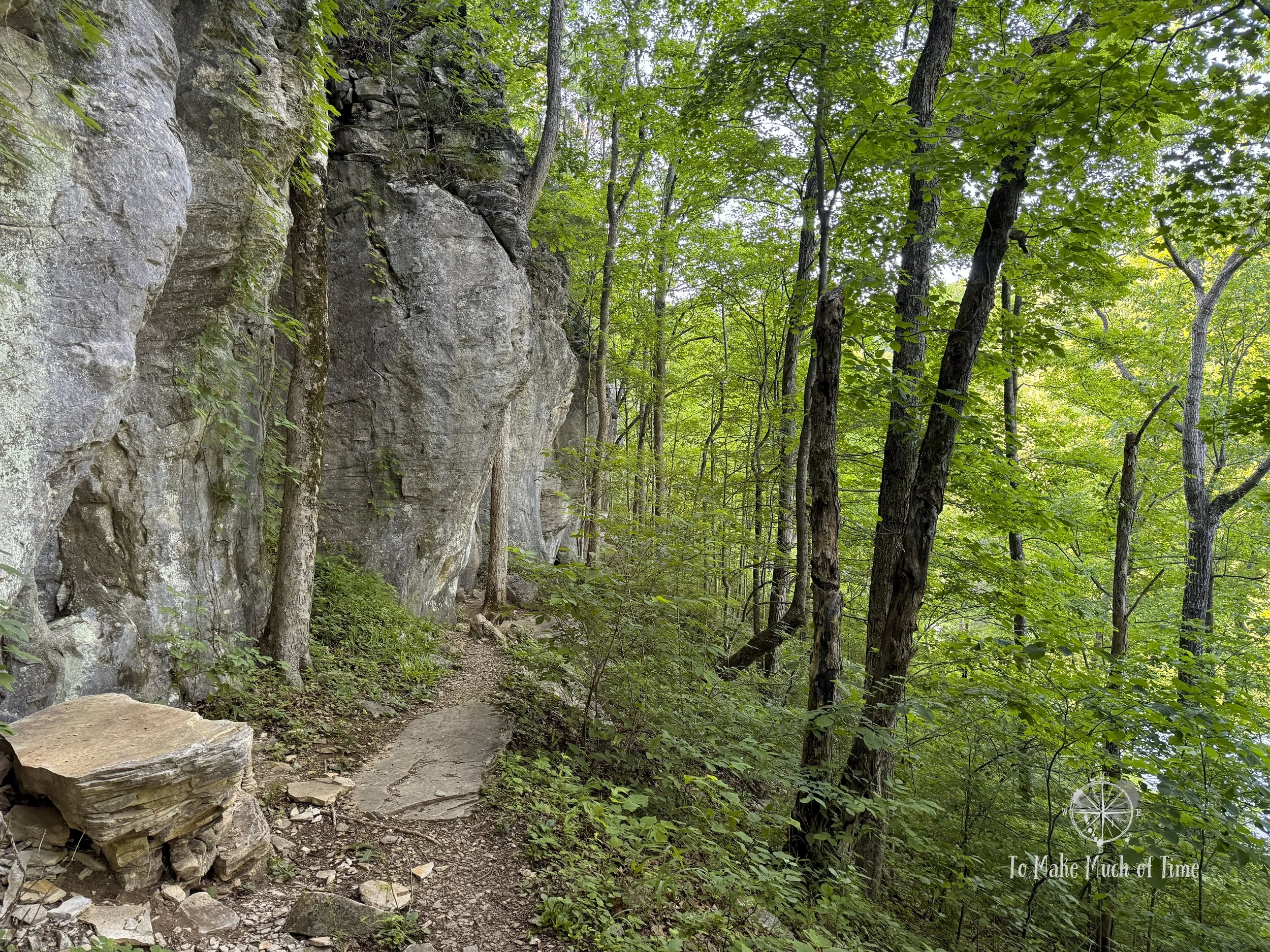
Hiking Carter Caves Cross Country Trail in Kentucky
First, a note on safety. While this isn’t the first lengthy, backcountry trail we have taken, it’s still a pretty new thing for us. For the first time, we decided to make a family member aware of our plans, announce our start time and estimated completion time, and then let them know when we were safely done. While other backcountry hiking we’ve done had us park at the trailhead, which would have been a sign to someone at some point that we hadn’t returned, in this case, people hike from all sorts of parking spots, and a car sitting at the Lodge would have told no one anything at all. We also made sure to bring our hydration packs (hiking backpacks with water bladders), snacks, and warm apparel.
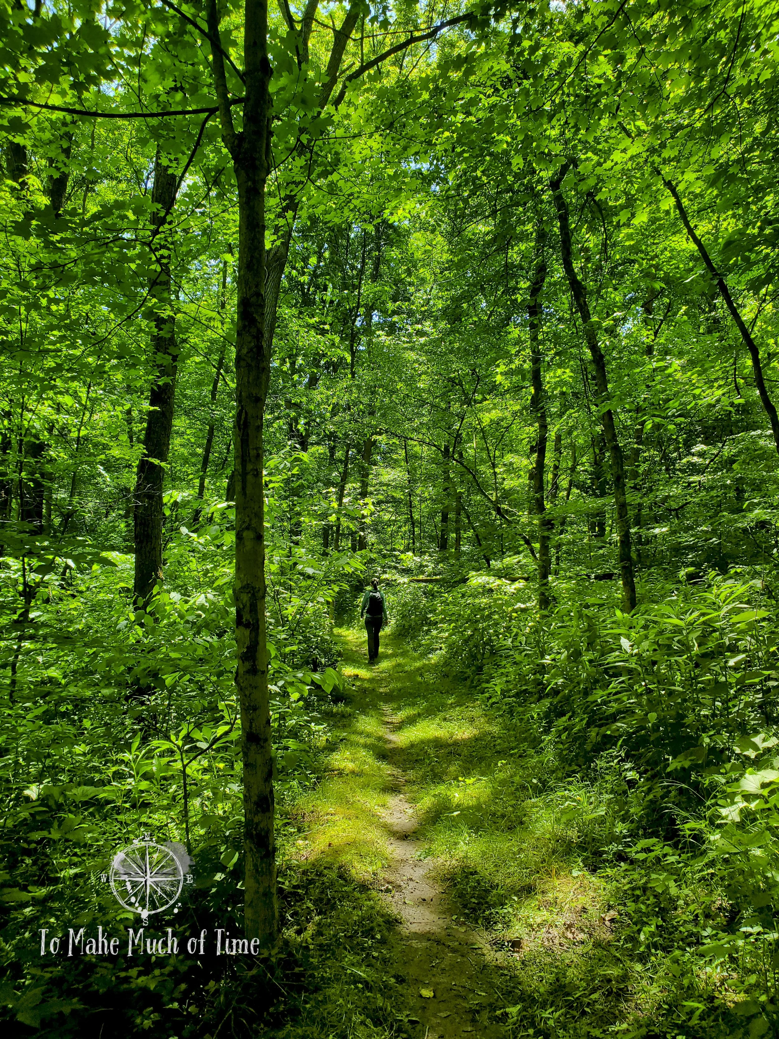
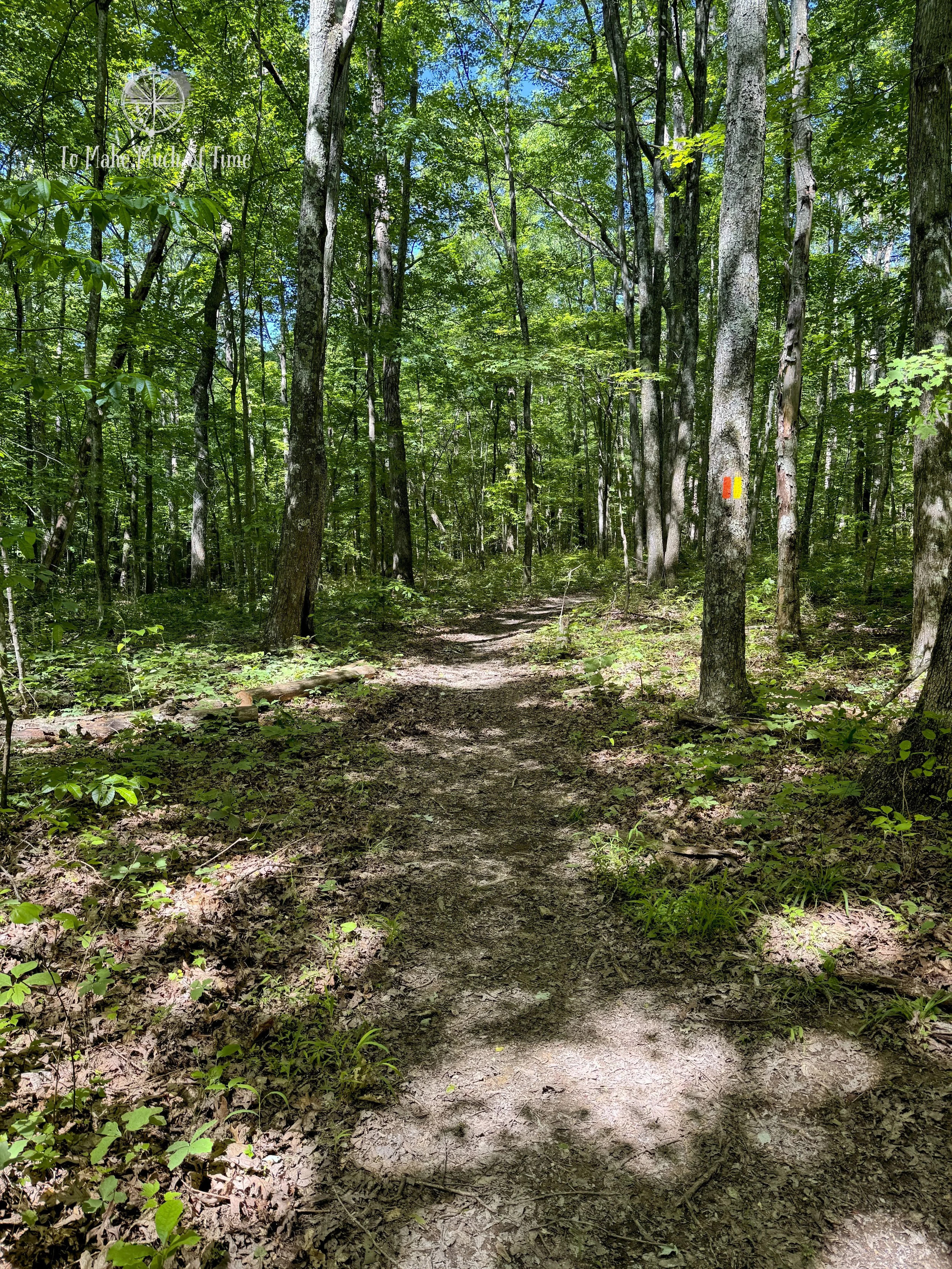
Our route: we parked at the Lodge and took the Three Bridges Trail for half a mile until we met up with the 4 Cs Trail. Fairly early on, we crossed the first of two suspension bridges, and then we came to the area that can be submerged when the water in the lake is high. Even without that issue, there were still slick rocks to maneuver over and a bit of a question in our minds as to where the trail went, though we could see blazing on the opposite bank. Other than that spot, this trail was really well marked and easy to follow. We passed through a meadow filled with pretty wildflowers and tall grasses that were not at all mowed. Around this time we stopped to pick multiple ticks off ourselves and continued to check for ticks during the remainder of the hike, though the tall grasses seemed to be the main culprit. The knoll overlooks the lake, and there was a man on a boat doing some early morning fishing. Beyond him, we wouldn’t see anyone else for about three hours. From there, the trail disappeared back into the woods and climbed to the ridge of the hills on the other side of the lake.

Hiking Carter Caves Cross Country Trail in Kentucky

Crossing a suspension bridge on Carter Caves Cross Country Trail in Kentucky

The start of the wildflower area that was pretty but tick-filled

Wildflowers along Carter Caves Cross Country Trail in Kentucky
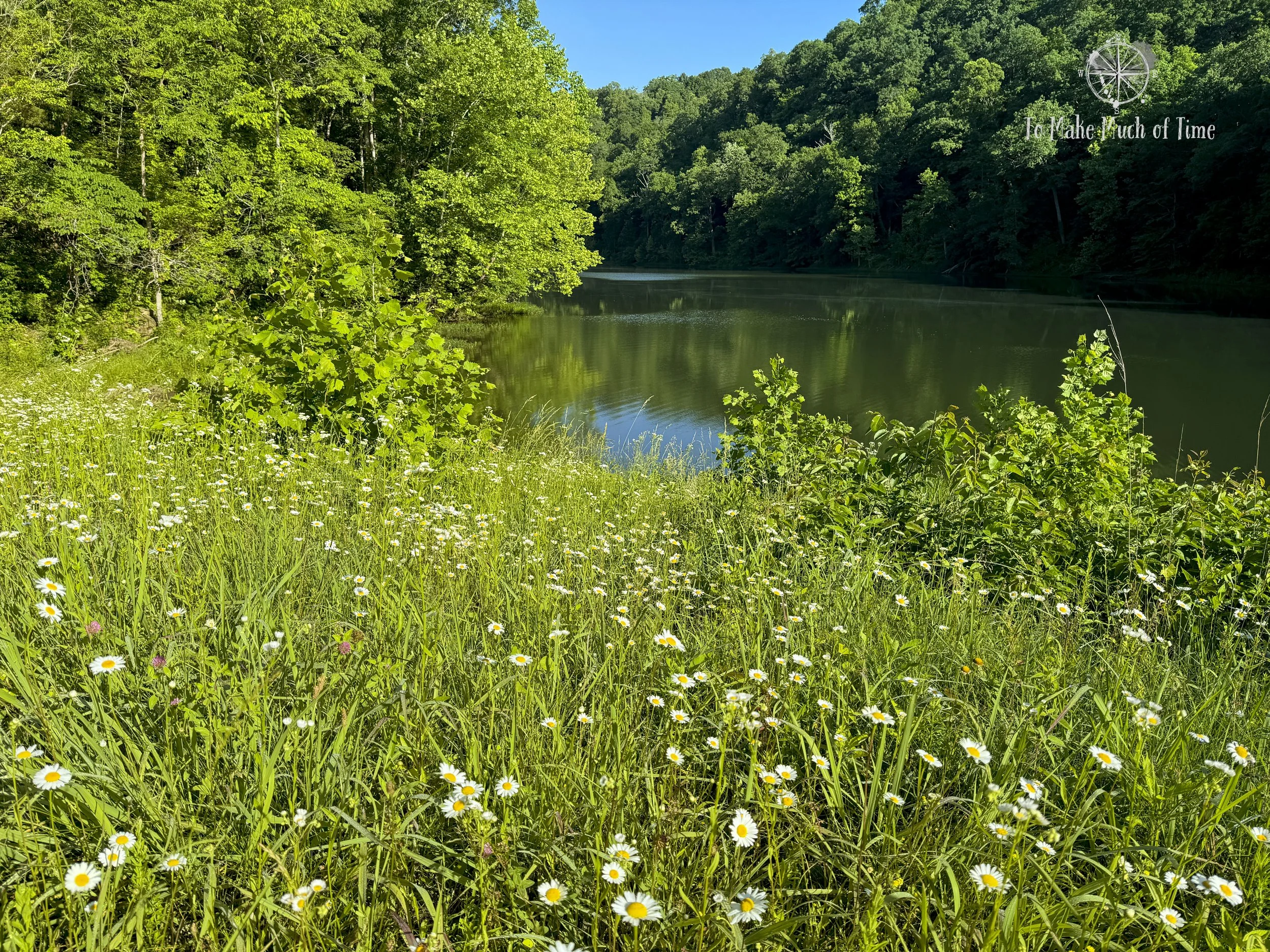
Wildflowers overlooking the lake at Carter Caves Cross Country Trail in Kentucky

Carter Caves Cross Country Trail in Kentucky

Butterflies in the wildflower meadow
Hiking Carter Caves Cross Country Trail

Hiking Carter Caves Cross Country Trail in Kentucky - the section that can become impassible during high water. Even in low water, it was a tad tricky to identify the way to cross to meet up with the trail.
The spot where the preceding photo led to meet back up with the trail and head uphill.

Looking back down at the area we crossed

And climbing the incline on the opposite side of the water
There are two by-permit-only backcountry camping sites on this trail, and the first one, called Johnson Homeplace, was up on the ridge. There was a platform for a tent, and behind the spot was a shallow, dark cave. I’m not sure I’d love camping with that right there personally, but otherwise, it looked like a nice spot! With occasional ups and downs that are typically of hilly terrain, much of this part of the trail was pretty constant and enjoyable. We also had a beautiful morning for the hike – late May, upper 50 degree temps, expected to rise to the mid 60s by the end of our hike.
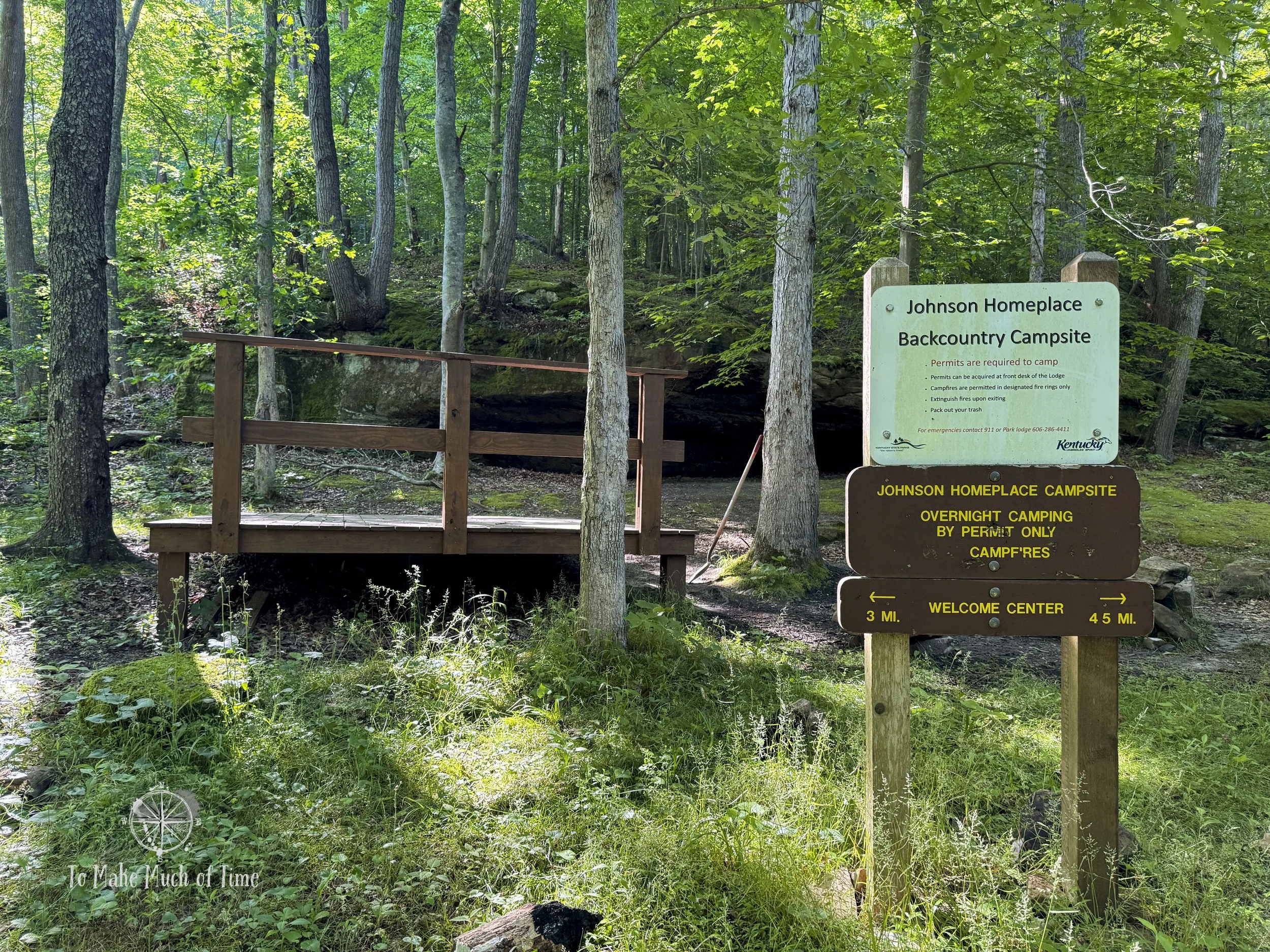
Creepy cave behind the Johnson Homeplace Backcountry Campsite

Hiking Carter Caves Cross Country Trail in Kentucky
The second suspension bridge was really cool. It was quite a bit longer and so sagged in the middle and bounced around a lot with footsteps. It wasn’t too high off the ground but probably not something those with a fear of heights would particularly enjoy. It was suspended over a moderate sized body of water. Just a bit further on, we came across the second backcountry tent camping spot, which appeared to have a roofed shelter.

Hiking Carter Caves Cross Country Trail in Kentucky
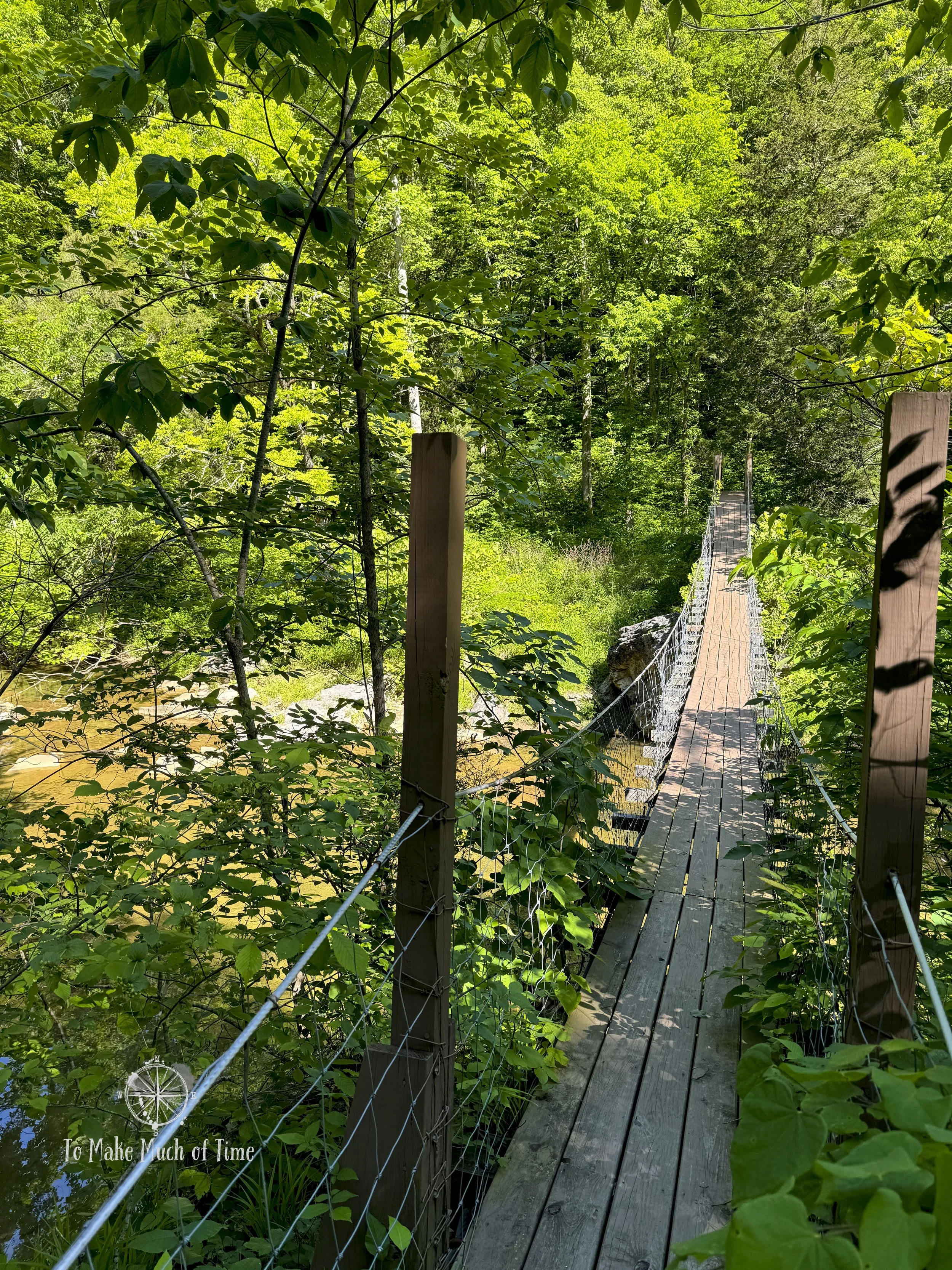
Second suspension bridge on Carter Caves Cross Country Trail in Kentucky

View from suspension bridge on Carter Caves Cross Country Trail in Kentucky

Hiking Carter Caves Cross Country Trail in Kentucky near Shangra La Arch
This trail is also home to Shangra La Arch, yet another of the natural arches in the park. In this case, the trail goes right through the middle of it. The front of the arch looks like the other arches, and then as you go further in, it becomes more shale-like, and the trail curves into a circular area, surrounded by shale. To get out, there is a tall, steep staircase (halfway between a staircase and a ladder). The entire trail portion that goes through the arch is rocky, and there are very clear bright orange arrows on rocks directing hikers where to go.

Carter Caves Cross Country Trail went right through Shangra La Arch and the trail was marked by many very clear arrows!

Hiking Carter Caves Cross Country Trail in Kentucky

Hiking Carter Caves Cross Country Trail - this part of the hike was unexpected after climbing through the rocks

Steep staircase up and out!
We’ve decided we’re not fans of multi-use trails where people are actually using them with horses. For the next segment of the hike, the 4 Cs Trail shared the route with the Kiser Hollow Trail, an 8+ mile multi-use (horses, bikes, hikers) trail. While they didn’t overlap for long, there were huge muddy sections where the ground was torn up from the horses. While there were very clear signs and fences to prevent people from taking horses on the neighboring trails, at least one person didn’t follow those rules. In fact, we could see a person had jumped horse over the fence to access one of them. Horseshoe prints don’t lie, people! The rest of the trail from here back to the Welcome Center was mostly up and downhill on a ridge. We enjoyed a wildflower meadow with a few playful butterflies and had a few more dried creek crossings (there were so many on this trail that we didn’t even try to count them).
Hiking Carter Caves Cross Country Trail in Kentucky where it met up with Kiser Hollow Trail
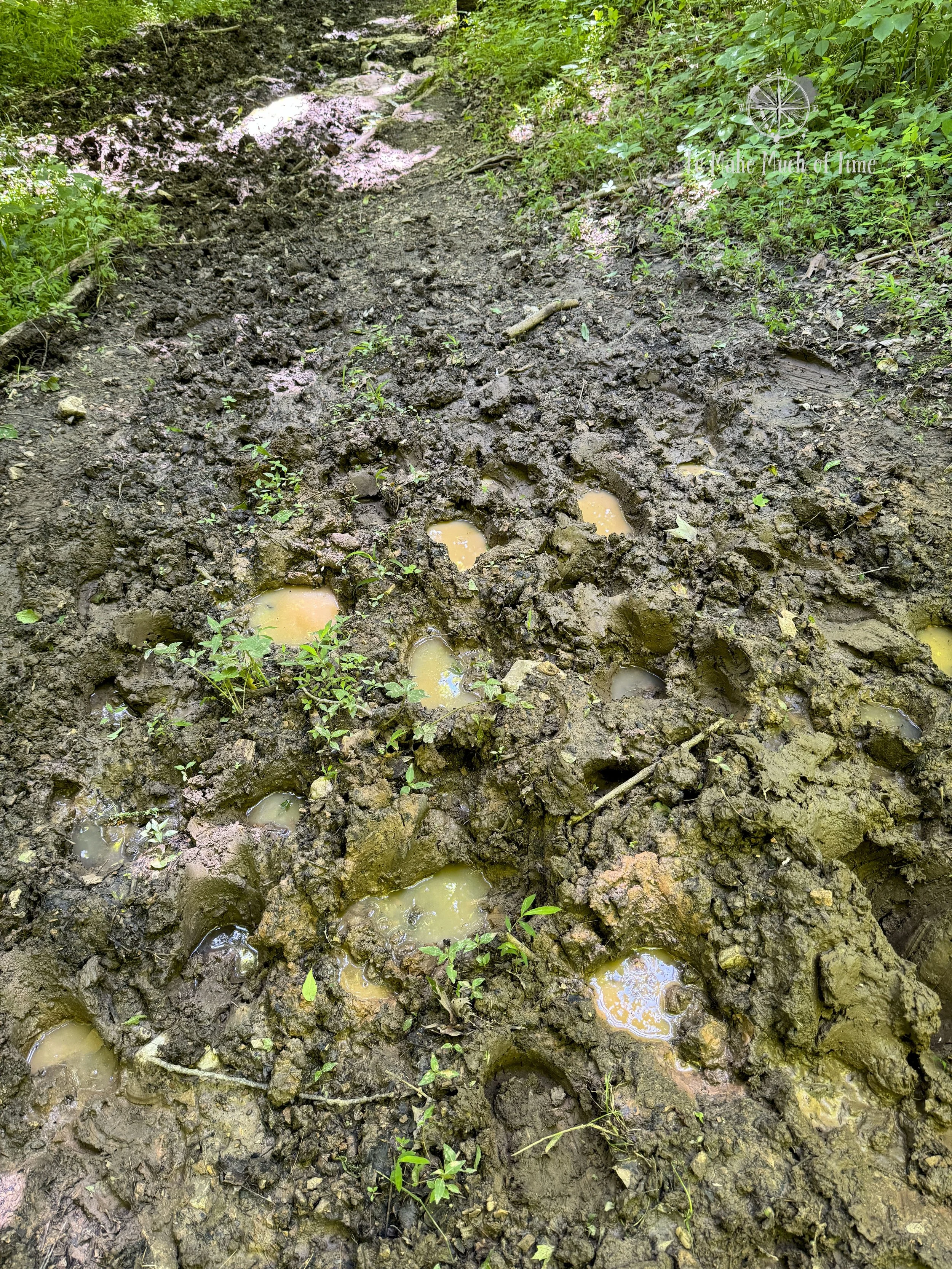
Mud from horses on the trail that is shared by Carter Caves Cross Country Trail and Kiser Hollow Trail

Carter Caves Cross Country Trail and Kiser Hollow Trail
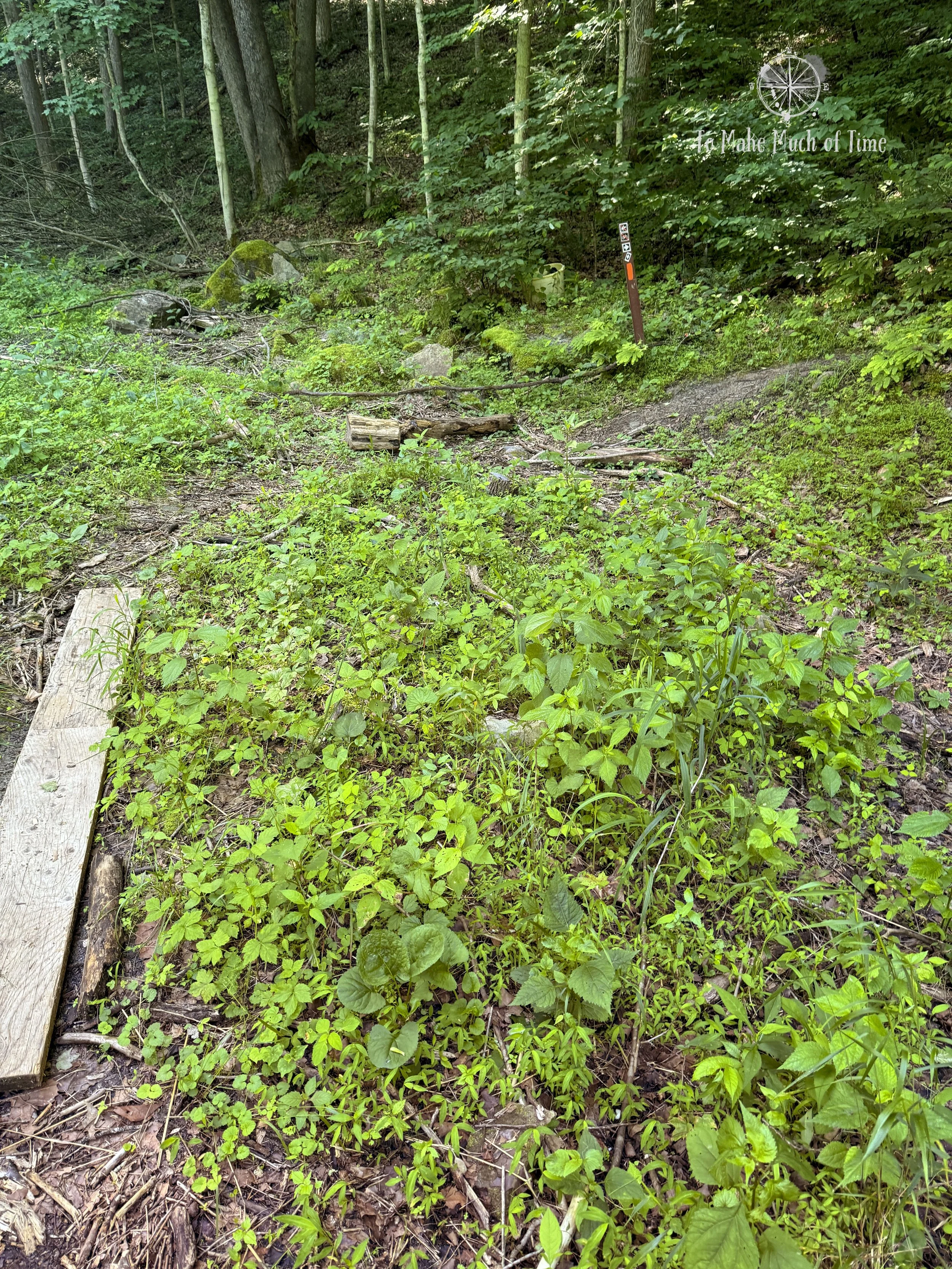
From the Welcome Center, we crossed uphill near Saltpeter Cave to catch back up with the Three Bridges Trail, which over the course of about a mile, got us back up to the Lodge. This is the section where we veered off from the main trail, which would have run alongside a different part of the Three Bridges Trail. For those who wanted to do the entire trail as it is intended, the best way to do it theoretically would be to start at the Welcome Center for direct trail access; however, I really do think starting where we did was smart to see whether the potentially impassable section was in fact impassable. The trail had a lot of poison ivy along it – just little plants here and there – and, as I said before, a decent number of ticks in the earlier part of the trail. It was on this trail that I finally learned to spot poison ivy. What can I say? I’ve semi-tried but hadn’t really felt the need to know what to look for until this trip.
We caught a late lunch at Tierney’s Cavern, both getting club sandwiches for the second day running, and headed back to the cabin to shower.
an evening dog adventure
As with any story involving a dog, my first question is whether it ends well. So, I’ll start by saying this one does. It is not particularly traumatic but just gross, unpleasant, and not at all the way we wanted to spend our final evening of our trip!
As you may know by now, we have three Labrador Retrievers (at our peak, we had 4, but alas they do not live forever). Our two yellow Labs have never eaten anything that caused them any issues, but our two chocolate Labs (biological sisters), clearly have a gene to eat things they shouldn’t. Tara has had one stomach surgery to remove a rope toy she found at a campsite, and Gretchen has had not one but two stomach surgeries to remove things she ingested that she shouldn’t have.
So it’s probably clear to you who our biggest problem child is and who is the star of this story: Gretchen. I won’t name names but a trashcan ended up on the floor, and we caught Gretchen face deep in it and could tell something was missing that wouldn’t necessarily travel through her system on its own. We did some Googling and found mixed info about whether the dog would pass the object okay or whether it could get stuck and require surgery, in which case getting the dog to vomit it up quickly was the better route.
So, we called our vet back home, just a few minutes before their closing time. They have cared for all our dogs and are fantastic. The vet recommended we take Gretchen to the 24-hour emergency vet to induce vomiting, only we were hours away. So, they guided us on the home remedy version of this: having the dog drink a small amount of hydrogen peroxide to change the acidity of their stomach and induce vomiting. (I shouldn’t have to say this, but for anyone who needs it, please consult your own vet before attempting anything like this on your pet.)
Luckily there was a Walgreens in the town of Olive Hill, 20 minutes away, that would be open a few more hours, so we popped over there, acquired a syringe to administer the hydrogen peroxide and then force fed it to Gretchen, who clearly didn’t enjoy it but was absolutely a good spot and didn’t fight it (much).
The vet said we needed to do a round of 3 tablespoons based on her weight and the max they recommend, wait 15 minutes, and if that didn’t work, do a second round. Because the syringe only held one teaspoon, poor Gretchen had to be force-fed 9 teaspoons (which equals 3 tablespoons for the non-chefs among you) of hydrogen peroxide and had to undergo the same after 15 minutes when the first effort wasn’t fruitful. It took probably another 8 minutes before the hydrogen peroxide worked its magic and then voila, out came the contraband. Later in the evening when we were sure Gretchen’s stomach was settled, she got a second dinner. If you know Labs, they love food, so it’s possible if Gretchen were writing this story, she’d be telling it as a total boon.
On the plus side, we’ve added an additional dog parent experience to our dog resume, should we ever need it again.
Yes, that is the end to our trip. Like I said, unexpected and not how we wanted to end it dealing with a dog emergency instead of a relaxing evening. Dustin did manage to re-light the remaining logs in the fireplace so we had a shorter peaceful evening before turning out the lights.
Click the image below to save this post to Pinterest!

Check out other posts in this trip series:


