
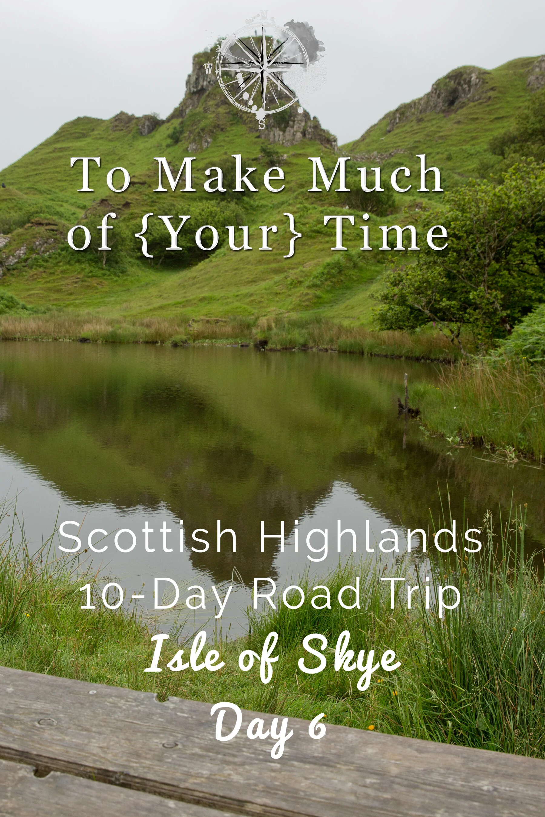
Scotland Road Trip: Isle of Skye (Day 6)

UPDATED: 2/5/2023
Note: Some links throughout our site are affiliate links, which means we may receive a small commission at no cost to you.
An Overview of the Isle of Skye
The Isle of Skye is part of the archipelago known as the Inner Hebrides. There are 79 islands of varying sizes with a little fewer than half inhabited. Of those, Skye, Islay, and Mull are the largest and most populated.
In case you are wondering, there are also Outer Hebrides, comprised of about 65 islands, only 15 of which are inhabited. They are further off-shore from the mainland and are only accessible by boat. I would love to do a Scottish islands trip in the future and visit more of the Inner Hebrides and make it to the Outer Hebrides as well.
The Isle of Skye has seen an uptick of tourism in recent years. Our server at dinner this sixth day of our trip and who had lived in the area for a while, explained that initially there were not enough accommodations for tourists traveling to the area so many ended up camping out in tents or in their cars. They have since increased accommodation options, but now there aren’t enough restaurants and other infrastructure for the influx of tourists during peak season. What this means is that you definitely want to make all reservations well in advance!
Exploring Skye
When we awoke in our AirBnb, we were treated to a beautiful morning vista of the harbor - seagulls and other ocean-loving birds soared around and the pale morning light shone on the water.
Our AirBnb included breakfast at The Portree Hotel, where we had dinner the prior night, so we headed there to eat. There was a continental breakfast laid out plus a small menu of entrees. Dustin and I both ordered Eggs Benedict, and my in-laws ordered a full Scottish breakfast and salmon and scrambled eggs. The food was palatable and relaxing in a restaurant was a nice way to fill up for the day of exploring which ahead of us. The restaurant also had strong coffee that was our most-American type coffee to date in Scotland!
Our plan for the day involved taking a roughly two hour loop road around one of the peninsulas of the Isle of Skye and doing short hikes to places of interest. This loop road around the isle that can get fairly crowded at times, and there are concerns in the area of over-tourism. In our experience, there was not anything like the traffic we have heard about, but this was certainly a fairly popular area and more populated than other parts of our trip.
Old Man of Storr
As we headed out of Portree on the loop road that we planned to take around the peninsula, the first spot we came to was the The Storr, a unique looking rocky outcrop on a mountain near the coast. Made of several large rock pillars pointed skyward, the largest has been named The Old Man of Storr. Hikers can scale the mountain, and we contemplated doing so. However the hike is moderately long, so we opted to save our energy for some other hiking while on Skye.
Legend has it that a giant was buried in the spot with only his thumb protruding above ground. This sounds like a believable explanation to me. Although it is not necessarily less exciting than the geologist’s explanation, which involves Earth-shattering volcanic eruptions resulting in massive lava flows across Skye (you can see the dark layered banding below and in many of the following pictures), followed by a huge landslip caused when the heavy volcanic layers slowly crushed the underlying sedimentary layers thus tilting the landscape and exposing what is now the cliff face. Erosion has been wearing away the softer rock leaving several jagged erosion resistant pillars standing.
As we approached The Old Man of Storr the sun peaked through the clouds and reflected off the lake and grass, the colors were so out of this world amazing Dustin had to pull over and take photos.
Lealt Falls
A very short distance down the road from the Old Man of Storr is Lealt Falls. After parking, there is a short walk to see the falls and then a large open area right along the cliff’s edge with beautiful views of the Sound of Raasay (which connects out to the ocean). It was incredibly windy along the edge, and it was easy to imagine being blown right off! …which has apparently happened to people (or at least they've gotten too close to the edge and slipped).
Dustin crouches to pull the rock walls of Lealt’s gorge into frame. (next image, or up to the right if in PC)
Abhainn An Lethuillt River (aka Lealt River) flows through a deep gorge with shear rocky walls.
The dark, peat-infused waters rushing down from Lealt Falls have an entirely different look than the rivers many of us are used to..
Abhainn An Lethuillt river empties into the ocean a few thousand feet after the falls.
At Lealt Falls stay clear of the edge if you are afraid of heights!
Wildflowers and grasses grow along the cliffs near Lealt Falls.
kilt rock and mealt falls
Just another short distance down the road was Kilt Rock. This is a very highly trafficked attraction (compared to the amount of parking) and was the only place where parking was a challenge. After waiting for 5-10 minutes we squeezed into a muddy spot and walked out to see the view. The cliff-face along the coast is said to look like a kilt, and to us, it really does. And, for comparison, a bag piper was there standing along the wind-swept cliff-top playing his pipe.
What makes a rock kilt? The lower strips of color are made of sedimentary rock which has been dated to the Jurassic Period, and yes, that means dinosaur bones have been found on Skye. Capping those sedimentary bands is a very thick layer of volcanic rock which cooled from lava after massive volcanic eruptions rocked Skye roughly 56 million years ago.
At the same site, Mealt Falls emits from the rock and plummets about 180 feet straight into the Sound of Raasay. It is relatively uncommon to see waterfalls that empty directly into the ocean, and it is an interesting sight!
With a bit of imagination one can see where the famous Kilt Rock gets its name.
Behind me was the striking Kilt Rock but the entire coastline in this part of the Isle of Skye is absolutely gorgeous.
Mealt Falls drop to the ocean along the same stretch of coastline where you can see Kilt Rock. Sometimes the wind blows so hard that water never reaches the bottom.
Mirroring the mountains in the distance, this tiny outcropping dreams of grandeur.
The Kilt Rock formation is composed of a thick top layer of solidified lava over top a thin layer of limestone and then several layers of banded Jurassic age sandstone.

These banded rock layers can be seen all along this stretch of the coastline. They date to the Jurassic period and many dinosaur bones have been found in the region.
Serenading us at Kilt Rock was a talented bagpiper. (Yes I made sure to get photo permission and gave a generous tip!)
Clinging to life in these harsh conditions mosses, grasses, and lichens make for beautiful scenery.
The small dirt road to the Kilt Rock parking lot wraps around this marshy pond.
The skye blue gallery
By this point in the day, we were getting peckish and so stopped at the Skye Blue Gallery right down the street hoping to grab lunch. The small art gallery has a little cafe but doesn’t offer full meals. However we were able to warm ourselves with coffee and nibble on some excellent scones which tided us over to lunch.
This cute place had very friendly service and was a nice stop to get us off the road and out of the wind for a little while!
Kilvaxter Souterrain
Exiting Kilvaxter Souterrain. Dark, cramped, and wet… that was exciting! (seriously)
It was Dustin’s research that found this spot that I suspect most people pass right by unbeknownst to them. A souterrain, for those who like me were unfamiliar with the word, refers to underground (from the French “sous terrain”) structures most often found in the Atlantic European area and from the Iron Age.
In practical terms, the souterrain is an underground tunnel lined with wood or rocks on the sides that accompanied areas where Iron Age people lived. The tunnels may have chambers off the main passageway. The current best guess by archaeologists is that they were used as storage areas for food or other items.
The Kilvaxter Souterrain was discovered in 2000 after heavy rains unearthed the opening on private land. Volunteers worked to restore the site, and archaeologists helped in its excavation. This particular souterrain is about 66 feet in length and has two openings - the main entrance and then an air/light shaft.
Off of the loop road, there is a small parking lot and a sign - if you’re looking for it in about the right spot, you should have no trouble finding it. From the parking lot, you walk over a small grassy field back from the road and then come upon the site pretty quickly.
Watch your head! The ceilings of Souterrains are usually quite low.
Visitors are able to enter the souterrain, but I’ll warn you that the opening is quite low. To enter, we had to almost get on our knees to crawl in, though I understand the height increases further along. Using our cell phone flashlights, we were able to walk in about 5 feet. Able to see a little distance ahead, we could tell that the ground was flooded with rain water just a little further on, so it wasn’t feasible to try walking through it any further.
For anyone else interested in checking the site out, make sure you have some sort of light - the inside is truly pitch black.
Nearby there are also remains of an Iron Age house that is believed to be from the same time period as the souterrain. I can’t imagine I will ever lose the excitement that comes from being able to explore and see such ancient remnants of humans!
With that much water on the floor of Kilvaxter Souterrain we stopped our exploration a few feet from the entrance.
Iron bars have been installed to block unwanted animals from entering the souterrain.
Lunch at bakurs in uig
Most of Skye is very rural with Portree being its largest city, so plan ahead for gas and food options. The first real option en route to eat lunch - by this point in the day it was well into the afternoon - was the harbor town of Uig, pronounced “oo-ig,” which had a couple of dining options open at the odd hour. Located on a pier, Bakur Bar, had a bar/diner sort of feel to it. I had a tuna sandwich, Dustin had a club sandwich, and our in-laws each had fish and chips. The food wasn’t spectacular but was certainly a decent place to stop on our journey.
the fairy glen
Take a rest at the relaxing pond at Fairy Glen after hiking the surrounding areas.
After lunch, we headed a very short distance to the Fairy Glen. This was one of my absolutely favorite spots in Scotland. As I mentioned in an early blog post, Scotland has an open-land law where basically anyone can walk or hike anywhere (subject to respectful behavior of course).
The Fairy Glen is an entire area with a winding road weaving through it, and I don’t know how to explain it without using the word magical. The bright green grassy hills had incredibly unique shapes to them that were unlike anything I have seen anywhere else. They almost looked concocted as if for a fantasy movie. There was no one path to follow but many routes that went up, over, around the various hills in a meandering fashion.
When we first parked the car at a pull-off, we could see a tall rocky pinnacle known as Castle Ewan in the distance. It was so high up and appeared to have a steep, smooth side that we were surprised to see what appeared to be tiny human forms walking around on top of it. How on Earth did they get to the top we wondered? We set off from where we parked walking along a well worn path that roughly followed the road snaking up into the surrounding hills. Sheep are free to roam the rolling hills and as a result have created very interesting pathways along the hills.
A lone sheep resolutely ignored us as we hopped out of our car at Fairy Glen.
The strange hilly landscape near Fairy Glen is the result of a geologic phenomenon called a landslip.
While you can take a more direct route to the rocks at Fairy Glen we took the long way.
With ferns and Foxgloves lining the path I think I took a picture every 2 feet or so.
The vibrant greens and purples made us feel as if we stepped into a magical relm.
With every hill we passed, I kept wanting to see what was behind the next!
Dustin attempting to line up a shot including both the Foxgloves but also the basalt outcropping (called Castle Ewan).
I think this photo of Castle Ewan came out pretty well.
Our hike at the Fairy Glen slowly took us closer to Castle Ewan.
The pond at Fairy Glen with the basalt rock named Castle Ewan in the background.
Looking down from this vantage point you would have no idea the road through Fairy Glen was just out of sight next to the pond.
Sheep graze on the hillside and help create the flattened pathways along the hillsides.
Do you see any faries here? This seems like prime fairy real estate.
The magical road to Fairy Glen is only wide enough for one car at a time.
We passed a stone wall just before ascending to the top of the large outcropping of rock at Fairy Glen.
After our meandering along the trail, we crossed the road, passed a stone fence, and made our way more steeply upward and found ourselves in an area just below that rocky outcropping. Within the grass below was an unexpected spiral pattern, and there was a route up to the top of the rock. Half of our party chose to climb it (I did not - it was a bit too windy), and instead I stood mesmerized by the environment around me.
When climbing to the top Dustin had to stop for a photo break
Grass and mosses thrive on the side of Fairy Glen’s basalt outcropping.
It is a long way down to the bottom of the Fairy Glen, be careful! (this is probably the wrong time to mention that the soles of my shoes were starting to come off… comfortable boots are hard to find!)

Even if you are afraid of heights climb to the top and look down at the Fairy Glen. The view is incredible!
Lindsey looked like an ant from the top.
The flowers of Fairy Glen are much more important than the spiral…. who’s with me?
To get back to the car, we had a few route choices and after a good-natured argument as to the “best” path, split up, finding our paths reconvening near a little lake at the bottom of the mountain. I took the steeper but straighter path back to the road while Dustin followed a longer route that put him on the far side of the pond where he walked through a thicket before meeting me back at the road.
The scenery of this spot left me speechless, and I feel it has now set the bar for amazing hikes I’ve gone on. In total, we walked only about a mile but spent about 55 minutes doing so because this is a hike that isn’t about a destination but about the winding route and sense of wonder it instills.
A wild Lindsey appears!
Where’s Waldo, aka Dustin?
The Fairy Glen spiral and Castle Ewan.
Sheep nibble along the hills at the Fairy Glen. What a peaceful life.
The scorrybreac trail
We returned to Portree and stopped in at the Sea Breezes restaurant - literally right next door to our AirBnb - and this is when we discovered how difficult reservations are to come by. This small restaurant had maybe 6-8 tables, and when we inquired about reservations for that evening, we found only one option for the four of us at 9:30pm, so we booked it! We quite literally got the last table of the night as the unfortunate party waiting in line behind us found out. Now that we had several hours before dinner we went back to our room to look for something to do.
Given that it was only about 7pm, we had several hours of daylight to spare. Dustin and I set off in search of what was described as an “evening walk” trail - The Scorrybreac Trail - that began along the coast of Portree, across the little bay from where we were staying. While we read that there was a small parking lot at the base of the trail-head we decided to take a walk around the harbor instead of driving to the trailhead. Most of this walk was pleasant and we had great views of the area, however a few spots had no sidewalk and roads that were uncomfortably narrow. Luckily, there were only a few cars so this wasn’t much of an issue.
Looking across Portree Harbor from our lodging. Cuillin Hotel is just up the hill from the road to the hiking path.
Looking back across Portree Harbor. I can see “my house”!
Pink roses grow up the side of a hotel.
I wish we had more natural stone walls in Virginia.
We had a little difficulty finding the start of the trail, which I think was more our confusion than anything else. Here is the site that we used to find the trail and which provides very thorough directions about what to expect. Our mistake was thinking the trail started up the hill near the hotel instead of down at the water, right near a boat ramp… reading is hard! After our confused hike up past the hotel we finally made our way down to the Scorrybreac Boathouse and found the trail. Initially, the path lead us through a thick tunnel of trees with a few views out onto the bay. We passed a memorial to Clan MacNeacail who donated their historic family land in 1987. You can read more about the history of the Nicolsons of Clan MacNeacail here. After a few minutes of walking, the trees abruptly ended and we looked out upon an incredible view of the surrounding area.
Upon finally arriving at Scorrybreac Boathouse and Skye Sailing Club we snapped a few pictures and found the trailhead.
At the beginning of the hike we walked through a dark tunnel of trees, excitement building.
Sitting and reading a good book while looking out at the harbor would be a pleasant way to spend a warm afternoon.
As we reached the end of the tree tunnel we began to make out the mountains in the distance.
We walked along the headland on a narrow (most of the way) path. Our initial views out over Portree’s bay slowly fell behind us as the path curved out and around, quickly putting all signs of civilization out of sight. From the trail the Isle of Raasay is visible. That island is where Bonnie Prince Charlie fled to hide after his loss at Culloden.
Looking up to the left, the steep slopes and rocky top of Ben Chracaig (ben is the Scottish word for mountain) could be seen high above us. We passed a section of the trail littered with enormous boulders. Some had clearly been there for quite some time but others appeared to be more recent additions. When we looked uphill, we could see a clear path of destruction from a section of the rock that looked freshly cleaved. The path of falling rocks looked at least several years old but something about the cliffs above seemed a little unstable, so it wouldn’t surprise me if more of the cliff-side erodes in the future.
Continuing on, the path continues to provides beautiful cliff views. Up until this point, we had been walking pretty slowly, taking in the views and snapping photographs; however, checking the clock, we began to worry that the path was taking significantly longer than we had planned, and we didn’t want to miss our dinner reservation. So, we stopped taking so many pictures and picked up the pace.
Across the loch you can see part of the Camastianavaig township and Ben Tianavaig.
Dappled with sunlight, the Isle of Raasay can be seen in the distance.
With amazing views in every direction, the Scorrybreac Trail was just amazing.
The path skirts the edge of Portree Harbor and is well marked and easy to follow.
Stone fences line parts of the trail. How long ago were these rocks placed here?
The Scorrybreac Trail takes you around Ben Chracaig. Looking up you can see that this rocky mountain may not be entirely stable.
This massive boulder was among dozens which have rolled down from above in recent years.
When I made the comment before about this being described as an “evening walk,” what I did not expect is after following the path inland we would reach a point (stage 4 in the hike directions) where we literally scaled the side of the mountain on a steep switchback route. Looking back at how the directions state that this part of the hike is “tiring” and recommends that hikers “take breaks” should have given us a clue, but either way we were both in shape so it was more of a surprise than an actual problem.
Oh hello there, giant hill to climb. We kept climbing and looking at the height above us, figuring the path must veer off at some point but knowing geographically that our final destination was on the other side of the mountain. Make sure that as you climb you turn around and look back; the view is incredible!
As it turned out, the path does not go directly up and over the mountain but veers off slightly before the peak and wraps around the back side away from the harbor. After catching our breath and curving down a gently declining path in the distance, we noticed dark storm clouds had begun to move into the area.
Slightly worried about getting caught in a downpour, we hurried along, although still keeping an eye toward the amazing scenery. Luck was on our side, and we both stayed dry and were treated to the most magnificent sight. As dark clouds churned overhead, a break in the gray mass opened and blinding beams of sunlight streamed through the clouds, lighting patches of ground beneath. As much as we were trying to hurry along to avoid the rain and make it in time for dinner, at every step of the way we were confronted with sights that we just had to stop to photograph!
After going through the steep section we found our path slowly curving downhill with the mountain on one side and a stone wall and pasture on the other.
Through a gap in the fence, I spied a tree begging for a photo..
Dark clouds let bright shafts of light beam down to bath the countryside in brilliant light.
As the clouds continued to move, the lighting changed rapidly and soon the rays were gone.
Finally, the path spit us out near the hotel on the hill and a residential area. We reached the harbor just as evening light streamed in from behind us and lit up the boats sitting in the harbor. The color and bright contrast between the colorful boats on a dark background made for wonderful photos. This scene alone would have made the hike worth it, but combining it with everything else made this yet another hike that goes into the books as one of the best hikes I’ve ever been on. Crazy how two of my favorite hikes were done in the same day!
We made it back to our AirBnb in time to clean up for dinner, all without getting caught in the rain that moved in shortly thereafter. In total, this “evening walk” lasted 2 hours and was 3.28 miles in length with a significant elevation climb. I would absolutely recommend it, but know what you are getting yourself into!
Evening sunlight peaked through the clouds just as we returned to Portree Harbor.
Evening sunlight brilliantly illuminates Scottish fishing boats against dark water and mountains.
Evening at Portree Harbor.
dinner at sea breezes restaurant
Not only was this Thistly Cross Cider delicious but it was massive! That’s a standard wine bottle next to it.
Waiting for our 9:30 reservations was totally worth it. We had a fantastic dinner - one of our best meals of the trip - at Sea Breezes. The small restaurant had a lovely ambiance along the quay, and the service was wonderful. The food itself is best described as seafood with an Italian angle to it. It was here that we were able to learn more from our server about life on Skye and the uptick of tourism.
I had salmon served with noodles, Dustin had cod, and my in-laws had mussels. For dessert, I had date pudding, a variation of the toffee pudding I had enjoyed the prior night, and Dustin had a brownie with sorbet. We all left happy and full.
This chocolate brownie with raspberry sorbet and peanut brittle was amazing! I’m drooling just remembering it!!
Our route for the day:
Click the image below to save this post to Pinterest!
Check out our other posts about Scotland:


The Fairy Pools and Eilean Donan Castle are up next!
Keep reading to follow our road trip!