
New Brunswick Road Trip - From Fundy to Kouchibouguac National Park 1-Day Itinerary

The walls of Fort Beausejour-Fort Cumberland, built in 1750-1751.
Note: Some links throughout our site are affiliate links, which means we may receive a small commission at no cost to you.
This is the 4th post in a series for this trip and covers day 5 of a 13 day road trip. You can view links to the other posts at the bottom of this one.
One day itinerary driving from Fundy National Park to Kouchibouguac National Park in New Brunswick
why drive from fundy national park to kouchibouguac national park
New Brunswick, Canada, has a total of two national parks - Fundy and Kouchibouguac. So, if you are an avid lover of the outdoors and find yourself in New Brunswick, visiting both just makes good sense! Fundy National Park is situated along the southern coast of New Brunswick, perched above the Bay of Fundy. Kouchibouguac National Park is also coastal but along the eastern side of the land, near the confluence of the Northumberland Strait and the Gulf of Saint Lawrence.
The drive from one of these parks to the other is about two hours as a straight shot. With our route, the trek was three hours of driving time. We figured we would not be in New Brunswick again anytime soon and wanted to take in more of the local history and ecology. If you’re not in a rush, I would recommend this route and the stops we added along the way.
MAKE THE MOST OF the drive from fundy to kouchibouguac
As we shared in our prior post, we stayed in the town of Alma, right outside the Fundy National Park entrance. We very much enjoyed our time in the area, and you can read more by visiting our 2-Day Itinerary for Fundy.
One spot we visited during our final day in Fundy was Hopewell Rocks. That spot is en route to Kouchibouguac and could easily be an added stop when driving from Fundy to Kouchibouguac.
We decided to have a slow start to the day - we were in no rush - and so went out for breakfast at Muddy Rudder (which is a stellar name for a restaurant) right in the small town of Alma, and walkable from our Airbnb. We opted for porch seating and were rewarded with people and dog watching. Pretty much everyone who walked by had one or more dogs. One man had two small dogs that looked to be French bull dogs. They shared a leash that had two offshoots, one per dog. As soon as they saw any other dogs, they first barked and then aggressively attacked each other. Yikes! One of the dogs looked to be quite a bit younger than the other so perhaps they were getting used to each other or were not used to being around other dogs. I am happy to report that all the other pups were having jaunty good mornings. There was nothing particularly exciting about the breakfast, but it was solidly good, which is usually all I’m looking for. Dustin had French toast with scrambled eggs and link sausage. I had a two egg breakfast – over easy with multi-grain bread and bacon.
It happened to be Canada Day and Alma had a parade, festivities, and fireworks planned, but unfortunately we’d miss all of that by a few hours. In any case, we enjoyed the decor throughout the town as we walked back from breakfast before hitting the road.

Beneath Fort Beausejour-Fort Cumberland’s earthenworks were rooms such as this one that stored anything from food wares to ammunition.

A drawing of the star-shaped Fort Beausejour-Fort Cumberland.
Our first stop along the way was Fort Beausejour - Fort Cumberland, one name each representing the French Acadian and British interests. As we were headed north to Kouchibouguac, we were going to be even more so in the traditional Acadian territory and knew that this fort would provide some local history, which appeals to us. The drive to the fort took us through the city of Moncton. While we didn’t stop, it looked like it had some cute areas, and there were a lot of people headed to the Canada Day festivities in town. We then stopped at La Dune de Bouctouche, which is a large sand dune maintained for ecological protection. There is a one-mile boardwalk trail that we enjoyed. Those looking for a lengthier option can walk the entire dune, which is 7.5 miles in one direction.
Finally, we arrived in the town of Kouchibouguac, a tiny blip of a place near Kouchibouguac National Park. There are far more limited options for food in this area. One pizza/Italian place that looked good only took cash so we ended up driving up to the river front down of Miramichi, 40 miles north, where we ate with a festive, inebriated crowd at O’Donaghue’s Irish Pub. There’s something about the noise and community that a pub brings out that is always fun. We went full monty with pub fare: nachos with jalapenos as an appetizer and then we each had fish and chips for our entrée. To wash it down, I enjoyed a sour IPA and Dustin had an apple cider, though I didn’t make note of the specific ones we each ordered. The rain that had tempered itself while we were in Fundy arrived with gusto, so we made quick dashes to and from the pub to the parking lot.

Pub fare at O’Donaghue’s Irish Pub in Miramichi, New Brunswick

O’Donaghue’s Irish Pub in Miramichi, New Brunswick
a brief history of fort beausejour - fort cumberland
There are a number of forts dotting the maritime provinces of Canada, a reminder of the bygone days of battles for control of the land between predominantly the French and British. The only one we visited on this trip was dual-named Fort Beausejour-Fort Cumberland due to its proximity to our route. This fort was built in 1750-1751.

The view from Fort Beausejour-Fort Cumberland.
The view from Fort Beausejour-Fort Cumberland.
Starting in the 1670s, French Acadians settled in this region, which was once home to the native Mi’kmaq people. Over time, the land became caught between French and British interests. As the British and French debated control of the land in Acadia, thousands of people were caught in the cross hairs and were ultimately forcibly removed from their land. The Treaty of Utrecht in 1713 determined that the British would control Acadia but didn’t clearly define the territory, leading to contention over borders. By the 1750s the debate heated up and to stake a claim, the British built Fort Lawrence along the Missaquash River. In response, the French built Fort Beausejour across the river. In the mid 1750s, about 3,000 Acadians lived in the region under the protection of Fort Beausejour, seeking refuge near the fort as the British increased their presence in the area. In June 1755, the fort suffered a siege by the British troops, who succeeded and gained control of Fort Beausejour. The British renamed it Fort Cumberland and continued to build and expand the star-shaped fort. About 2,200 of the region’s Acadians were pushed out of the region and spread out to many different destinations, including in the US. They were undesirable to other areas and struggled to find a place to which to flee. After that time period, the fort was often unused, though it did see brief usage during the War of 1812. It was decommissioned in 1833 by the British, and then the land was leased to farmers. In 1920, it was declared a historic site.

From inside the earthenworks, the subterranean rooms are visible and visitors can explore them on their own.

Weaponry at Fort Beausejour-Fort Cumberland
visiting fort beausejour - fort cumberland
Because we happened to visit on Canada Day, the museum waived the entrance fee and also had cake for visitors. There are several picnic benches nearby the fort, and we ate a picnic lunch at one before exploring the site.
The small museum hosts information about the fort’s history and features a number of archaeological finds and other items of interest found on site and from the surrounding region. The museum provides a window into the maritime Acadian region over the past couple of centuries.

The museum at Fort Beausejour-Fort Cumberland held artifacts from the region.

The museum at Fort Beausejour-Fort Cumberland held artifacts from the region.

An up-close shot of the walls at Fort Beausejour-Fort Cumberland with the really cool orange lichen that is growing all over them.
The fort itself is primarily earthenworks forming a star shape, which was reflective of European fort techniques in the 1750s. Behind these earthen walls were trenches, casements, and other tactical and logistical elements of the fort. The shape of the fort allowed guns to be installed for maximum reach and to create cross-fire from different arms of the star. Visitors can wander throughout the fort and the underground rooms at their own pace and stand atop the ramparts for long-range views of the region. Nearly 300 years later, the view has changed a bit but still features much of what a French soldier would have seen when serving as a look-out.

A 3D model of Fort Beausejour-Fort Cumberland in the museum on site.

Part of Fort Beausejour-Fort Cumberland’s ruins within the fort.

A really cool door within Fort Beausejour-Fort Cumberland leading to an underground store room.
visiting la dune de bouctouche
La Dune de Bouctouche is owned and maintained by J.D. Irving, a New Brunswick-based company that began life as a sawmill and today serves multiple sectors, including shipbuilding and forestry. As part of their corporate sustainability measures, the company owns a few park lands, open for free to the public. La Dune de Bouctouche is one of their holdings. The dune is one of the longest in New Brunswick at 7.5 miles long. It is home to unique plants and animals and - like sand dunes the world over - is always changing with the tides, wind, and storms.
Visitors can walk on the raised boardwalk that is 0.5 miles in length (1 mile round-trip). The trail is dotted with informational signs. The path took us about 40 minutes to walk in total at a very leisurely pace. The area right off the boardwalk is also used as a beach for sunbathers, who were soaking up the warm New Brunswick summer during our visit. Those who wish to trek out to the end of the dune, can walk the full length but should know that the route is not protected by shade.
Some of the wildlife that spends time at the dune: the Great Blue Heron, many types of shellfish (mussels, clams, and more), lobsters, and the red fox. We saw many red fox paw prints on the sand.

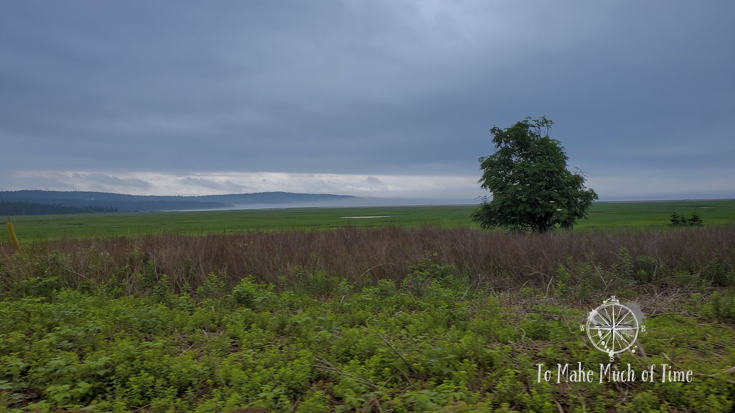
The coastal drive on our way to La Dune de Bouctouche.

The view from the boardwalk at La Dune de Bouctouche.

The view from the boardwalk at La Dune de Bouctouche.

The view from the boardwalk at La Dune de Bouctouche.
This is the route we took from Alma to Kouchibouguac:
Click the image below to save this post to Pinterest!

Check out other posts in this trip series:


